

Pastures Green and Coastline Seen
Pastures Green and Coastline Seen
Hiking in and around the Ring of Kerry

As we are coming to the end of our time in Cahersiveen (we have about a week left here), I thought it would be nice to give you a sense of the principal attraction of being in this part of the world: the beautiful scenery. So here’s a post with lots of photos! And I promise, Ireland looks like this every day.
Valentia Island, Part 1
As Gelsey mentioned in her post about Cahersiveen, we were very intrigued by Valentia Island, a large-ish but sparsely populated island off the northwest coast of the Ring of Kerry. The island features views both of the Ring of Kerry and the Dingle Peninsula, and we’ve now been able to get out to Valentia Island twice, once with a friend of mine who lives in Limerick and helpfully came for a visit with her car, another time via foot/ferry.
Our first visit was based around a hike all the way at the western end of the island: the Bray’s Head loop. This was one of the hikes in the region I had most wanted to do, and it did not disappoint. About every 10 minutes, I was muttering, “wow, what a view” and stopping to take a photo.
The first half of the loop is hiked along the southern edge of the western end of Valentia Island, which features stunning views of both the Kerry Cliffs and the Skelligs.
We stopped along the way for a picnic lunch.

Eventually, we came out to the Bray Head Watchtower at the point of the peninsula.
Then we curved back around to the north side of the peninsula (and hiked up to the highest point of the trail), which offered tremendous views of Dingle Bay and the whole of Valentia Island.
Valentia Island, Part 2
A week later, Gelsey and I returned by ourselves to the other end of Valentia Island, Knightstown.

Knightstown is the largest population center on the island, with an estimated permanent population of about 300, but it’s also a cute tourist town that comes to life in the summer. (The ladies working at the café where we had lunch said that they are only open from late May to mid-September.)
A fun aspect of our journey to Knightstown was taking the ferry across the body of water (I still can’t quite figure out what it’s called) between Reenard Point and Knightstown. The small car ferry (it accommodates only about 12 cars) runs continuously, and after a roughly 1-hour walk out to the ferry terminal, we only had to wait about 5 minutes for the ferry to arrive.
The journey across is quick – no more than 10-15 minutes, and then we were right in the town. The day was hot, and we noticed a number of people cooling off in the water around the marina (where the ferry pulls in) and other people taking the good weather as an opportunity to do some sea kayaking or sailing.
It takes no more than 15 minutes to walk around pretty much the entirety of the town, and we had only 2-3 lunch options to pick from. We wound up at Knightstown Coffee House, where we enjoyed both the food and the agreeable company of the two ladies working.
The other item of note from Knightstown is the cable house. The cable house was the operations hub at one end of the first transatlantic telegraph cable, laid between Valentia Island and Newfoundland. I had thought this had accomplished seeing an unusual pair of buildings (having been to the other on my trip to Newfoundland a few years ago), but I misremembered the site I had seen in Newfoundland, which was actually the site of the first transatlantic wireless signal. Now, apparently, I’ve seen half of two different historical events. To complete the two sets, I evidently need to go back to Newfoundland and make a first visit to Cornwall.

Kerry Cliffs
On the day we went out to Bray Head, we also hiked the Kerry Cliffs. These “only slightly less spectacular than the Cliffs of Moher” cliffs were impressive in their own right, but they also offered the best views of the Skelligs and a great view back to where we had just hiked out to the Bray Head watchtower.


During our hike of the Bray Head Loop we had gotten a bit lost and wound up trekking through tallgrass and heather, which meant that even the short walk out to the cliffs was pretty hard, but we were glad to do it. We look exhausted, but also happy!

Beentee
The town of Cahersiveen is nestled just between the estuary of the Fertha River and a mountain called Beentee. There are a few trails around/up Beentee, so, on a nice day last week, Gelsey and I hiked to the top. The trail was about 6 miles in distance with a total of roughly 1,500 feet of elevation gain.
We went clockwise (which is the recommended direction). This involves leaving town to the east-northeast, and largely circling the base of the mountain while ascending at a quite shallow gradient. The more we kept going, the greater a sense of foreboding I had, because after maybe 2 miles, we had barely gone up much at all. We had gone up enough, however, to already get amazing panoramas of the valley to the east

Parts of the trail were along gravel roads, and these were relatively easy to manage, but other parts were through fairly thick vegetation. We often crossed through fields of cows and sheep. While the animals weren’t often near us, they were friendly company nearby (we were otherwise totally alone).

Between separate fields, there were often little ladders, untraversable by Bovidae, that we scrambled over.

Eventually, the trail made a right turn, which involved going straight against the gradient of the mountain. It’s very difficult to capture the steepness of the gradient in a photo, but I took this one, angled perpendicular to the trail.

Eventually, we made it up to the ridge of the mountain, and from here, the gradient was a bit more manageable up to the first summit.

There were more sheep on top, taking advantage of the stiff breeze on a warm (for here) day.

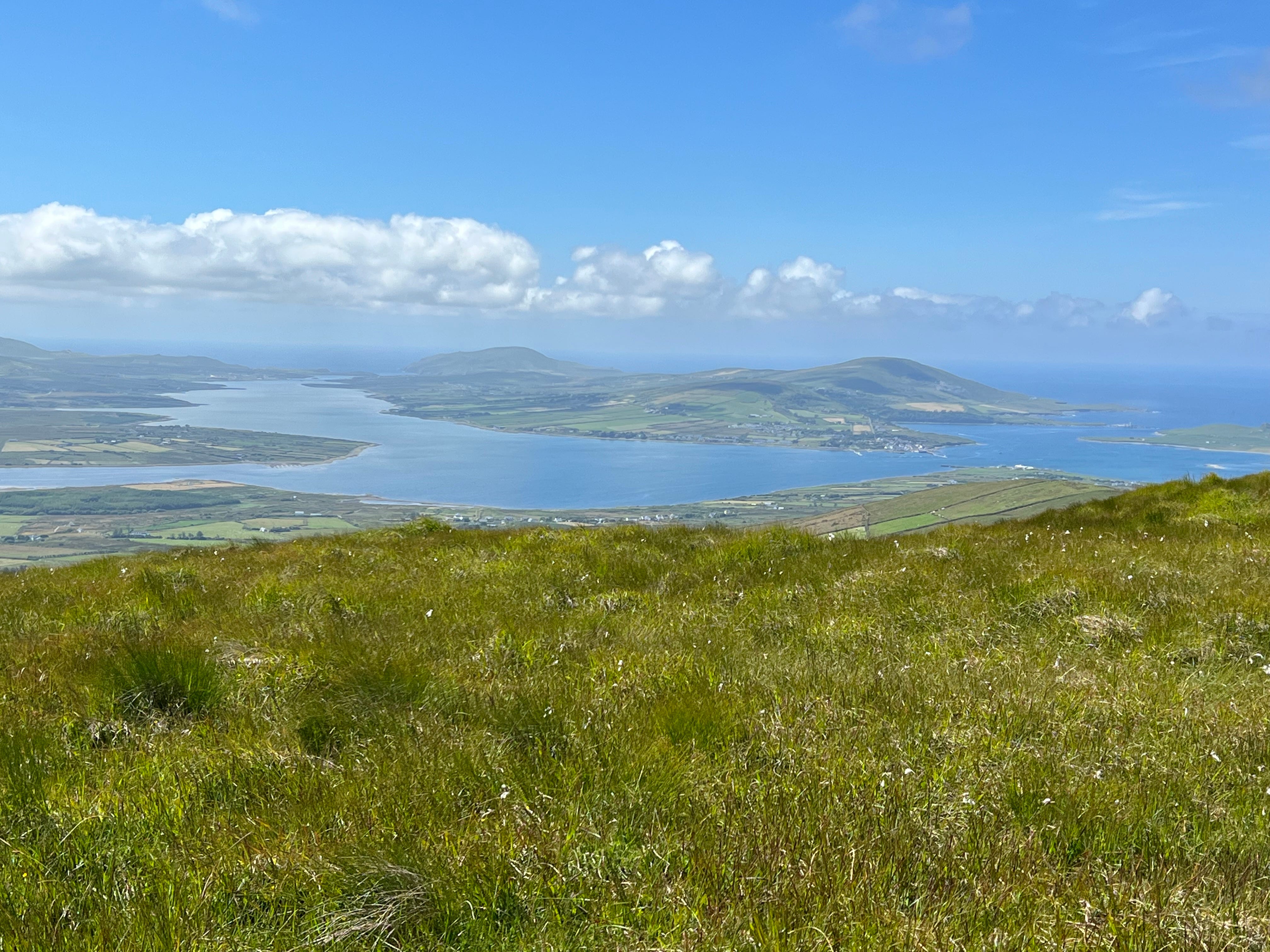
We had a phenomenal view of Valentia Island from the top
I was there too!

After following the ridge back west to the highest summit, the trail split up, with different-length journeys back into town. We opted for the shortest of these. Reaching the ridge of the trail that offered panoramas to the northwest was special. Valentia Island is to the left; in the distance at roughly 30 degrees left of center are the Blasket Islands off the end of the Dingle Peninsula; straight ahead in the distance is the Dingle Peninsula itself; to the right is the even taller mountain (in Kerry), Knocknadobar, and another mountain on the Dingle Peninsula. The Fertha River estuary appears on both sides of the hump of Beentee on the descent, which itself blocks most of the view of Cahersiveen down below.

We did get one opportunity for a slightly better view (from above) of Cahersiveen

And then we were delayed momentarily as we tried to sort out which way the trail went through a field of cows. We were something of a novelty to the cows, and one of them seemed to take a liking to Gelsey and followed her for a few paces.

Beaches
With my visiting friend from Limerick, we drove out to Derrynane Beach, which offered views of the southernmost spot along the Ring of Kerry and the Beara Peninsula beyond. Derrynane is a lovely beach that stretches for quite some distance with a lovely shallow gradient into the ocean and ample protection from large waves. There were a number of jellyfish washed up on the shore, but not so many as to interfere with taking a stroll. The beach also offers views of an ancient abbey on an island straight across.

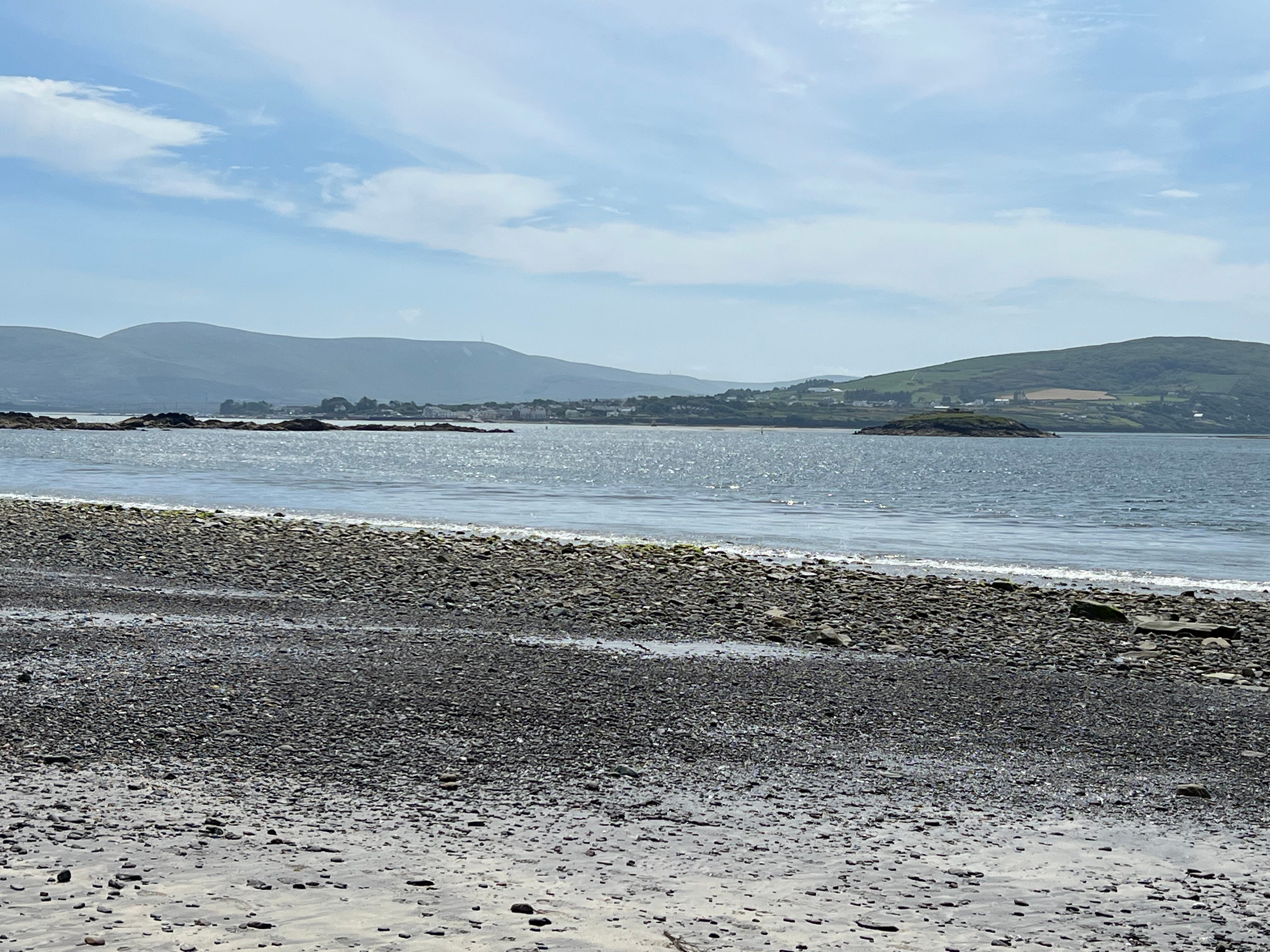
Gelsey and I also took a day to walk out to Whitestrand, which was a bit farther than we realized. After getting there, about the only energy we had was to sit there and eat our picnic lunch. This wasn’t a very nice beach, but it did offer views of Knightstown across the water.
The walk out to the beach also took us by two ancient circle forts, Cahergall (seen below) and Leacanabuaile (not pictured or pronounceable). Caher (or Cathair in Irish) actually means stone fort. And on one of our other walks around town, we found Caher Sive, for which the town, Cahersiveen, is named.

More to come soon from Gelsey on our culinary adventures here.
What a stunning and especially adventurous report (I'm charmed by those unassuming but useful ladders placed between fields.) This report definitely requires that culinary follow-up given my nagging questions at each (literal) trail turn : "but what kinds of snacks does one pack for cliff-side trekking? does one pre and/or post-carbo-load for all this rigorous activity?!?"